
Identifikasi tutupan vegetasi dan potensi fisik lahan untuk pengembangan ekowisata di laboratorium lapangan konservasi sumberdaya hutan dan ekowisata hutan pendidikan Unhas
Downloads
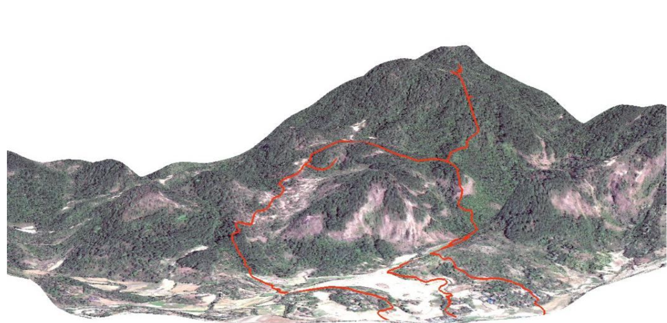
The aims of this study are to identify vegetation coverage and physical potential of land that can be developed as an ecotourism attraction, and plan for the management of ecotourism development space in the Field Laboratory of Forest Resources Conservation and Ecotourism, Unhas Educational Forest. Vegetation cover, was interpreted from satellite images by using remote sensing techniques, while the physical land potential data information was collected through direct measurements in the field by using GPS, compass and meter. Data analysis was done by using GIS with overlay method and Digital Elevation Model (DEM). The results showed that the Field Laboratory of Forest Resources Conservation and Ecotourism, Unhas Educational Forest, has natural forest vegetation and pine plantations forest covering 91.32% of the total land area of 311 ha, that potentially for the development of ecotourism. Some interesting physical potential to be developed as an ecotourism attraction, is a waterfall, mountain peaks, camping ground and a research station.
Achmad, A. 2011. Rahasia Ekosistem Hutan Bukit Kapur. Brilian Internasional. Surabaya.
Achmad, A. 2012. Peranan Vegetasi Dalam Konservasi Kawasan Karst. Disajikan pada Workshop Ekosistem Karst: Untuk Kelangsungan Hidup Bangsa. Pusat Penelitian Biologi-LIPI. Cibinong Science Center, Tanggal 3 Mei 2012.
Departemen Kehutanan. 1993. Kebijakan Pembangunan Sumberdaya Hayati dan Ekosistemnya. Direktorat Jenderal Perlindungan Hutan dan Pelestarian Alam.
Fandeli, C. 2001. Dasar-Dasar Manajemen Keparawisataan Alam. Liberty. Jogyakarta.
Idrus, N., A. Saefuddin, and S. Pertiwi. 2001. The Development of GIS – Based Decision Support System for Determining Suitable Area of Dairy Catle Farm. Journal of GIS,
Remote Sensing and Dynamic Modelling. SEAMEO-BIOTROP. No.1. Year 2001.
Kementerian Kebudayaan dan Pariwisata. UNESCO. 2002. Panduan Dasar Pelaksanaan Ekowisata. Dinas Pariwisata dan Kebudayaan: Nias.
Lindenberg, K. dan Huber, R.M. 1993. Isu-Isu Ekonomi dalam Pengelolaan Ekoturisme. Ekoturisme: Petunjuk Untuk Perencana dan Pengelola. USAID.
Lukman, H. 2004. Dasar-Dasar Ekowisata. Malang: Bayumedia
Lo, C. P. 1996. Penginderaan Jauh Terapan. UI Press: Jakarta.
Puntodewo, A., S. Dewi dan J. Taringan. 2003. Sistem Informasi Geografis Untuk Pengelolaan Sumberdaya Alam. Center For International Forestry Research.
Tempo. 2010. Target Pendapatan Pariwisata Maros 7,7 Miliar. Edisi 10 Juni.
The International Ecotourism Society. 1990. What is Ecotourism. (online) Http://www. ecotourism.org. Diakses tanggal 24 Mei 2010.
VietNews. 2010. Ha Long Bay Vies For Honors In World Wonders. Oct 13.
Yoeti, O. A. 2000 Ekowisata Pariwisata Berwawasan Lingkungan. P.T. Pertja: Jakarta.
