
Land capability evaluation for land use recommendation in Lawo watershed
Downloads
The changes of forest uses into agricultural land is a serious problem in Lawo watershed, South Sulawesi.
Agricultural practices without implementing soil conservation and adequate agro-technology has caused high level
of soil erosion and low land productivity. Management in Lawo watershed must be done with integrated soil and
water conservation in order to increase agricultural production. This effort can be done with land capability
evaluation. The purpose of this study is to evaluate the land capability of Lawo watershed using land capability
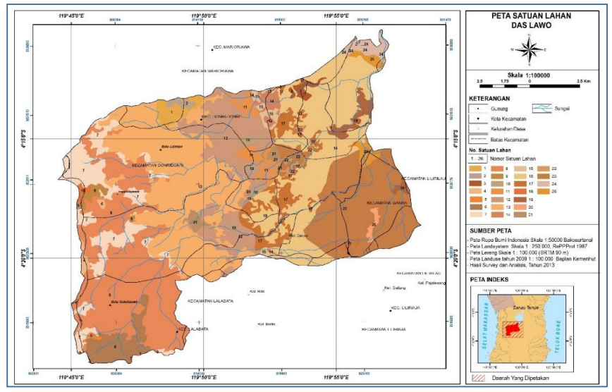
category for data analysis. The results showed that Lawo watershed is dominated by land capability of class III with
erosion (middle) as the dominant limiting factor which covers about 17,476.42 ha (49.68%). In addition, the class
of land capability is followed by class IV with the slope (moderately steep) as the limiting factor and erodibility of
soil (middle) covering about 10,059.8 ha (28.6%), land capability of class VI with slope (Steep) as the limiting factor
with 7,638.32 ha (21.72%) coverage area. Land with class III can be recommended for dryland farming with
adequate application of agro-technology, and water and soil conservation. While class IV and VI are not
recommended for agricultural activities but for private forest or plantation forest.
Arsyad (2010). Konservasi Tanah dan Air. (edisi ke dua) Bogor: Serial Pustaka IPB Press.
(BPS) Badan Pusat Statistik Indonesia (2015). Produksi Tanaman Pangan Nasional 1993 – 2015. http: // www.bps.go.id /Subjek /view /id /53#subjek ViewTab3| accordion-daftar subjek3. Diakses 02 Desember 2015.
(BPS) Badan Pusat Statistik Kabupaten Sopeng (2013). Kabupaten Soppeng dalam Angka Tahun 2013. Soppeng: BPS.
Banuwa IS, Sinukaban N, Tarigan SD, dan Darusman D. (2008). Evaluasi Kemampuan lahan DAS Sekampung Hulu. Jurnal Tanah Tropika, 13(2), 145-153.
(BPDAS) Balai Pengelolaan Daerah Aliran Sungai
Jeneberang Walanae (2012). Laporan Hasil Identifikasi Kerusakan DAS Lawo Tahun 2012. Makassar:
BPDAS.
Halim F. (2014). Pengaruh Hubungan Tata Guna Lahan Dengan Debit Banjir Pada Daerah Aliran Sungai Malalayang. Jurnal Ilmiah Media Engineering, 4(1), 45-54.
Jijun HE, Qiangguo CAI, Guoqiang LI, and Zhong W. (2010). Integrated erosion control measures and environmental effects in rocky mountainous areas in northern China. International Journal of Sediment Research, 25(3), 294 –303.
Maryati S. (2012). Land Capability Evaluation of Reclamation Areain Indonesia Coal Mining Using LCLP Software. Procedia Earth and Planetary Science, 6, 465 – 473.
Meyer LD. (1981). Modelling Conservation Practices. p. 31 – 44. In Soil Conservation: Problem and Prospects Ed: RPC. Morgan, A Wiley Interscience Publivation.
Murtilaksono, K., E.S. Sutarta, H.H. Siregar, W. Darmosarkoro, dan Y. Hidayat. (2008). Penerapan Teknik Konservasi Tanah dan Air dalam Upaya Penekanan Aliran Permukaan dan Erosi di Kebun Kelapa Sawit. Prosiding Seminar dan Kongres Nasional MKTI VI, 17-18 Desember 2007, Cisarua Bogor: 165-171.
Nezami MT. (2013). Effect of land use types and slope on soil Erodibility factor in Alborz province, Iran. International Research Journal of Applied and Basic Sciences, 4(1), 25-30.
Panhalkar S. (2011). Land Capability Classification for Intergrated Watershed Development By Applying Remote Sensing And GIS Techniques. ARPN. Journal Of Agricultural dan Biological Science, 6 (4), 46-55.
Pertiwi N, Sapei A, Januar MJP, Astika I W. (2011). Pembangunan konsep Ekohidrolik Sebagai Upaya Pengendalian bencana Wilayah Pemukiman pada Sungai Lawo kabupaten Soppeng. Jurnal Forum Bangunan, 9(1), 26- 33.
Ping LY, Sung CTB, Joo GK and Moradi A. (2012). Effects of Four Soil Conservation Methods on Soil Aggregate Stability. Malaysian Journal of Soil Science, 16, 43-56.
Pratiwi dan Narendra BH. (2012). Pengaruh Penerapan Teknik Konservasi Tanah Terhadap Pertumbuhan Pertanaman Mahoni (Swietenia Macrophylla King) Di Hutan Penelitian Carita, Jawa Barat (The Effect of Soil Conservation Application on the Growth of Mahogany (Swietenia macrophylla King) Planting System in Carita Forest Research, West Java). Jurnal Penelitian Hutan dan Konservasi Alam, 9(2), 139-150.
Saida, Jusoff K, Islan M, Haris A, and Nraeni (2013). Evaluation of Land Capability for Agriculture in the Upstream of Jeneberang Watershed, South Sulawesi. American-Eurasian Journal of Agricultural & Environmental Sciences, 13(8), 1027-1033.
Santoso B. (2012). Murbei varietas NI (varietas unggul). http://balithutmakassar.org/murbei varietas-ni/. Di akses tanggal 6 Januari 2015.
Sinukaban N. (2007). Peranan Konservasi Tanah dan Air dalam Pengelolaan Daerah Aliran Sungai.” Dalam Fahmudin Agus et al (2007) (Penyunting). Bunga Rampai Konservasi Tanah dan Air. Jakarta: Pengurus Pusat Masyarakat Konservasi Tanah dan Air Indonesia 2004-2007.
Sitorus RPS. (2010). Land Capability Classification For Land Evaluation: Review. Jurnal Of Agricultured Land Resource, 4(2), 69-78.
Soekotjo, 2009. Teknik Silvikuture Intensif. Makalah pada malam orasi penerima anugerah Hamengku Buwono IX Dies Natalis ke-60 Universitas Gajah Mada, Yogyakarta, 19 Desember 2009.
Vorone RP, Vanven JA, and Paul EA.(1981). Organic carbon dynamics and grass land soil. Model validation and simulation of the long term effects of cultivation and rain fall erosion. Canadian journal of soil science, 61, 211-224.
Wischmeier WH and Mannering JV. (1969). Relation of soil properties to is Erodibility. Soil Science of American Proceding, 33, 131 – 137.
Yalew D. and Yilak T. (2014). A GIS based Land Capability Classification of Guang Watershed, Highlands of Ethiopia. Journal of Environment and Earth Science, 4(22), 161- 165
