
Degraded Land Analyses of Brantas River Basin to Support Land Rehabilitation
Downloads
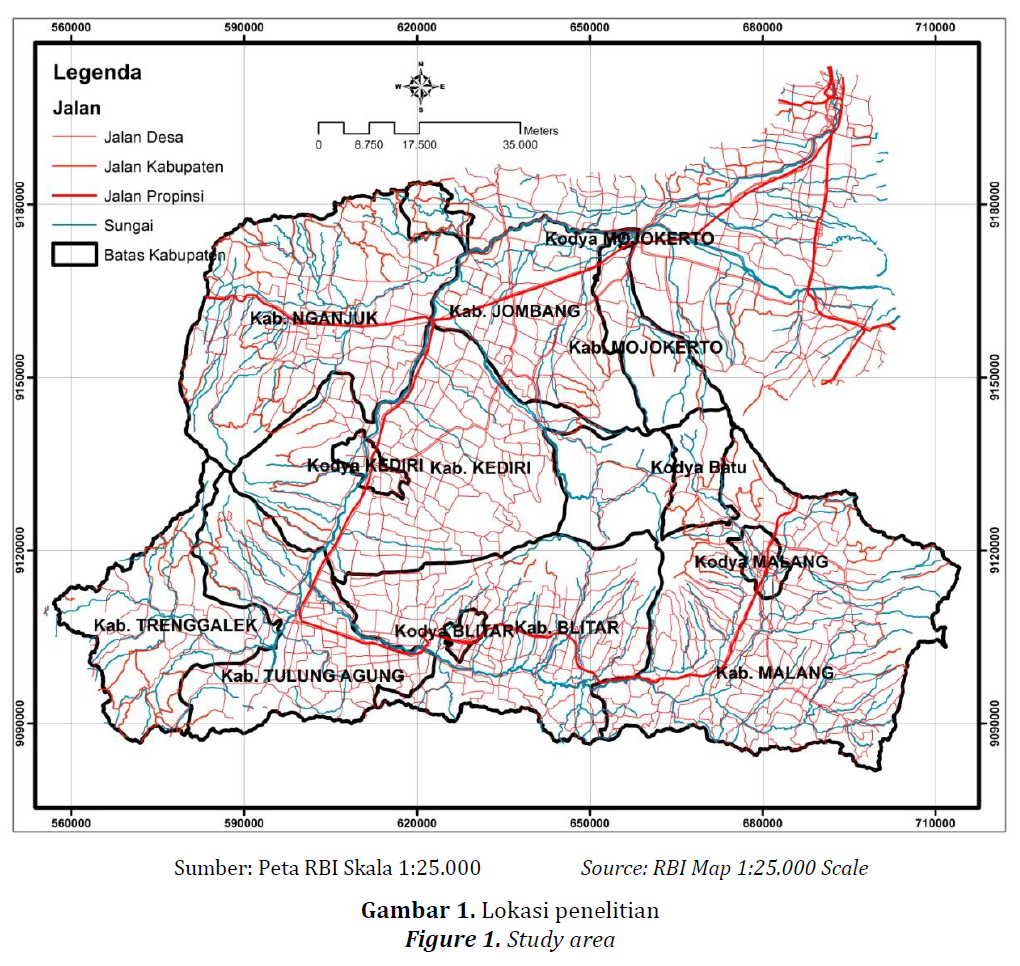
Land degradation in the Brantas River Basin occurs very massively as reflected by high erosion and sedimentation. Information related to soil erosion is important since it is one of the basic information in determining the degraded land in a watershed. The purpose of this study was to analyze and identify the distribution of degraded land in the Brantas river basin as an effort to mitigate land degradation through forests and land rehabilitation in suitable locations. Erosion analysis was carried out spatially on a watershed scale using the USLE (Universal Soil Lost Equation) method. Analyses showed that weighted soil erosion values in the Brantas river basin were448.73 tons/ha/year which was classified as high erosion level. The area of 408,818 ha (41.74%) of Brantas river basinneeds erosion handling because 22.51% was identified in the high erosion value category and 19.23% was included in very high erosion values. Those areas were identified as protected forests, production forests, dry land, and mixed gardens. The type of soil and the erodible of soilare part of the determinants of the high value of erosion, but these factors are difficult to manage while land cover types and land management which are the causes of erosion are relatively manageable. The approach to rehabilitate forests and land can be used as an effort to prevent and reduce erosion by taking into account the selection of related types of habitus (form and stratification) and economic value.
Anwar, M., Pawitan, H., Murtilaksono, K., &Jaya, I. N. S. (2011). Respons Hidrologi Akibat Deforestasi di DAS Barito Hulu, Kalimantan Tengah. Jurnal Manajemen Hutan Tropika XVII(3), 119-126.
Asdak, C. (Ed.). (2010). Hidrologi dan Pengelolaan Daerah Aliran Sungai. Yogyakarta: Gadjah Mada University Press.
Barrio, P. O. D., Giménez, R., & Campo-Bescós, M. Á. (2017). Assessing Soil Porperties Controlling Interrill Erosion: An Empirical Approach Under Mediterranean Condition. Land Degrad. Develop., 28, 1729-1741. doi: DOI: 10.1002/ldr.2704
Devianti. (2018). Kajian Tingkat Laju Limpasan Permukaan dan Erosi Berdasarkan Pengelolaan Tanaman Pertanian Sistem Agroforestry di DAS Cianten-Cipancar, Provinsi Jawa Barat, Indonesia. JTEP Jurnal Keteknikan Pertanian, 6(1), 109-116. doi: DOI: 10.19028/jtep.06.1.109-116
Direktorat Jenderal Pengendalian Daerah Aliran Sungai dan Hutan Lindung.(2018). Petunjuk Teknis Penyusunan Data Spasial Lahan Kristis, Pub. L. No. P.3/PDASHL/SET/KUM.1/7/2018. Jakarta: Kementerian Lingkungan Hidup dan Kehutanan.
DirektoratJenderal Reboisasi dan Rehabilitasi Lahan. (1995). Pedoman Penyusunan Rencana Teknik Lapangan Rehabilitasi Lahan dan Konservasi Tanah Daerah Aliran Sungai. Jakarta: Balai Pengelolaan Daerah Aliran Sungai Jeneberang-Walanae Makassar, Direktorat Jenderal Reboisasi dan Rehabilitasi Lahan.
DirektoratKehutanan dan Konservasi Sumber Daya Air. (2012). Analisa Perubahan Penggunaan Lahan di Ekosistem DAS dalam Menunjang Ketahanan Air dan Ketahanan Pangan: Studi Kasus DAS Brantas In BAPPENAS (Ed.). Jakarta: BAPPENAS.
Du, Z.-L., Zhao, J.-K., Wang, Y.-D., & Zhang, Q.-Z. (2017). Biochar addition drives soil aggregation and carbon sequestration in aggregate fractions from an intensive agricultural system. J Soils Sediments 17, 581-589. doi: DOI 10.1007/s11368-015-1349-2
Duan, X., Xie, Y., Ou, T., & Lu, H. (2011). Effects of Soil Erosion on Long-term Soil Productivity in The Black Soil Region of Northeastern China. Catena, 87, 268-275.
Ferreira, V., Panagopoulos, T., Andrade, R., Guerrero, C., &Loures, L. (2015). Spatial variability of soil properties and soil erodibility in the Alqueva reservoir watershed. Solid Earth, 6, 383-392.
Geissler, C., Kühn, P., Böhnke, M., Bruelheide, H., Shi, X., & Scholten, T. (2012). Splash Erosion Potential underTree Canopies in Subtropical SE China. CATENA, 91, 85-93.
Hendra, T. L. (2013). Dampak Perubahan Penggunaan Lahan terhadap Tingkat Kekritisan Air Sub DAS Citarum Hulu. Majalah Geografi Indonesia, 27(1), 26-37.
Herawati, T. (2010). Analisis Spasial Tingkat Bahaya Erosi di Wilayah DAS Cisadane Kabupaten Bogor. Jurnal Penelitian Hutan dan Konservasi Alam, VII (4), 413-424.
Junaidi, E. (2013). Peranan Penerapan Agroforestry terhadap Hasil Air Daerah Aliran Sungai (DAS) Cisadane. Jurnal Penelitian Agroforestry, 1(1), 41-53.
Junaidi, E., & Indrajaya, Y. (2018). Respon hidrologi akibat penerapan pola agroforestri pada penggunaan lahan yang tidak sesuai kesesuaian lahan Jurnal Penelitian Kehutanan Wallacea, 7(1), 69-81.
KementerianLingkungan Hidup dan Kehutanan. (2017). Statistik Lingkungan Hidup dan Kehutanan Tahun 2016. Jakarta: Pusat Data dan Informasi, Sekretariat Jenderal Kementerian Lingkungan Hidup dan Kehutanan
Khare, D., Mondal, A., Kundu, S., &Mishra, P. K. (2017). Climate change impact on soil erosion in the Mandakini River Basin, North India. Appl Water Science, 7, 2373-2383. doi: DOI 10.1007/s13201-016-0419-y
Kurnia, U., Sutrisno, N., & Sungkawa, I. (2010). Perkembangan Lahan Kritis. In K. Suradisastra, S. M. Pasaribu, B. Sayaka, A. Dariah, I. Las, Haryono & E. Pasandaran (Eds.), Membalik Kecenderungan Degradasi Sumber Daya Lahan dan Air(pp. 143-160). Bogor: IPB Press.
Kurnia, U., & Suwardjo. (1984). Kepekaan Erosi Beberapa Jenis Tanah di Jawa menurut Metode USLE. Pemberitaan Penelitian Tanah dan Pupuk, 3, 17-20.
Lipu, S. (2010). Analisis Pengaruh Konversi Hutan terhadap Larian Permukaan dan Debit Sunia Bulili, Kabupaten Sigi. Media Litbang Sulteng, 3(1), 44-50.
Mashudi, Susanto, M., & Baskorowati, L. (2016). Potensi Hutan Tanaman Mahoni (Swietenia macrophyllaKing) dlam Pengendalian Limpasan dan Erosi. J. ManusiadanLingkungan, 23(2), 259-265.
MenteriKehutanan Republik Indonesia. (2009). Keputusan Menteri Kehutanan Nomor: SK.328/Menhut-II/2009 tentang Penetapan Daerah Aliran Sungai (DAS) Prioritas dalam Rangka Rencana Pembangunan Jangka Menengah (RPJM) Tahun 2010-2014). Jakarta.
Ming, L., Yu-kuan, W., Pei, X., Bin, F., Cong-shan, T., & Shan, W. (2018). Cropland physical disturbance intensity: plot-scale measurement and its application for soil erosion reduction in mountainous areas Journal of Mountain Science 15(1), 198-210. doi: https://doi.org/10.1007/s11629-017-4574-x
Moges, DesalewM., & H.GangadharaBhat. (2017). Integration ofgeospatial technologies withRUSLE foranalysis ofland use/cover change impact onsoil erosion: case study inRib watershed, north western highland Ethiopia. Environ Earth Sci 76, 765. doi: DOI 10.1007/s12665-017-7109-4
Mondal, A., Khare, D., & Kundu, S. (2016). Impact assessment of climate change on future soil erosion and SOC loss. Nat Hazards 82, 1515-1539. doi: DOI 10.1007/s11069-016-2255-7
Mukherjee, A., & Lal, R. (2013). Biochar Impacts on Soil Physical Properties and Greenhouse GasEmissions Agronomy, 3, 313-339. doi: doi:10.3390/agronomy3020313
Munibah, K., Sitorus, S. R. P., Rustiadi, E., Gandasasmita, K., & Hartrisari. (2010). Dampak Perubahan Penggunaan Lahan Terhadap Erosi di DAS Cidanau, Banten. Jurnal Tanah dan Iklim, 32, 55-69.
Naik, S. K., Maurya, S., & Bhatt, B. P. (2017). Soil organic carbon stocks and fractions in different orchards of eastern plateau and hill region of India. Agroforest Syst., 91, 541-551. doi: DOI 10.1007/s10457-016-9957-4
Olivares, B., Verbist, K., Lobo, D., Vargas, R., & Silva, O. (2011). Evaluation of The USLE Model to Estimate Water Erosion in an Alfisol. J. Soil Sci. Plant Nutr., 11(2), 71-84.
Olivi, R., Qurniati, R., & Firdasari. (2015). Kontribusi Agroforestri terhadap Pendapatan Petani Desa Suoharjo Kecamatan Sukoharjo Kabupaten Pringsewu. Jurnal Sylva Lestari, 3(2), 1-12.
Ozsahin, E., Duru, U., & Eroglu, I. (2018). Land Use and Land Cover Changes (LULCC), a Key to Understand Soil Erosion Intensities in the Maritsa Basin. Water 10(3),1-15. doi:10.3390/w10030335
Paningbatan Jr., E. P. (2001). Hydrology and Soil Erosion Models for Catchment Research and Management. In A. R. Maglinao & R. N. Leslie (Eds.), Soil Erosion Management Research in Asian.
Phama, T. G., Degener, J., &Kappas, M. (2018). Integrated universal soil loss equation (USLE) and Geographical Information System (GIS) for soil erosion estimation in A Sap basin: Central Vietnam. International Soil and Water Conservation Research 6, 99-110.
Rees, F., Dhyèvre, A., Morel, J. L., & Cotelle, S. (2017). Decrease in the genotoxicity of metal-contaminated soils with biochar amendments. Environ Sci Pollut Res 24, 27634-27641. doi: DOI 10.1007/s11356-017-8386-x
Rhoades, J. L., Demyan, M. S., & Orr, B. (2011). Impacts of Deforestation and Land Cover Change on Mountain Soils in Hrazdan, Armenia. Journal of Sustainable Forestry, 30, 677-696.
Santi, L. P. (2017). Pemanfaatan Biochar Asal Cangkang Kelapa Sawit untuk Meningkatkan Serapan Hara dan Sekuestrasi Karbon pada Media Tanah Lithic Hapludults di Pembibitan Kelapa Sawit. Jurnal Tanah dan Iklim 41(1), 9-16.
Sharma, A., Tiwari, K. N., & Bhadoria, P. B. S. (2011). Effect of Land Use Land Cover Change on Soil Erosion Potential in an Agricultural Watershed. Environ Monit Assess,173, 789-801.
Sigalos, G., Loukaidi, V., Dasaklis, S., Drakopoulou, P., Salvati, L., Ruiz, P. S., & Mavrakis, A. (2016). Soil erosion and degradation in a rapidly expanding industrial area of Eastern Mediterranean basin (Thriasio plain, Greece). Nat Hazards, 82, 2187-2200. doi: DOI 10.1007/s11069-016-2288-y
Tombus, F. E., Yuksel, M., Sahin, M., Ozulu, İ. M., & Cosar, M. (2012). Assessment Of Soil Erosion Based On The Method USLE; Çorum Province: Example Rome, Italy: TS05E -Technical Aspects of Spatial Information II, 5848.
Wahyuningrum, N., & Wardojo. (2008). Analisis Kemampuan Lahan di Sub DAS Tajum.Paper presented at the Seminar Nasional Hasil Penelitian “Teknologi, Sosial Ekonomi dan Kelembagaan Sebagai Basis Pengelolaan DAS Purwokerto.
Wahyunto, & Dariah, A. (2014). Degradasi Lahan di Indonesia: Kondisi Existing, Karakteristik, dan Penyeragaman Definisi Mendukung Gerakan Menuju Satu Peta Jurnal Sumberdaya Lahan 8(2), 81-93.
Weischmeier, W. H., & Smith, D. D. (1978). Predicting Rainfall Erosion Losses; A Guide to Conservation Planning. Agriculture Handbook, 537, 1-59.
Widianto, Suprayogo, D., Sudarto, & Lestariningsih, I. D. (2010) Implementasi Kaji Cepat Hidrologi (RHA) di Hulu DAS Brantas, Jawa Timur. (pp. 1-133). Bogor: World Agroforestry Centre, ICRAF Southeast Asia Regional Office
Xu, G., Lu, K., Li, Z., Li, P., Wang, T., & Yang, Y. (2015). Impact of soil and water conservation on soil organic carbon content in a catchment of the middle Han River, China. Environ Earth Sci, 74, 6503-6510.
