
Estimation Model of Site Quality of Teak (Tectona grandis) Using Very High-Resolution Imagery from Unmanned Aerial Vehicle in KPH Nganjuk
Downloads
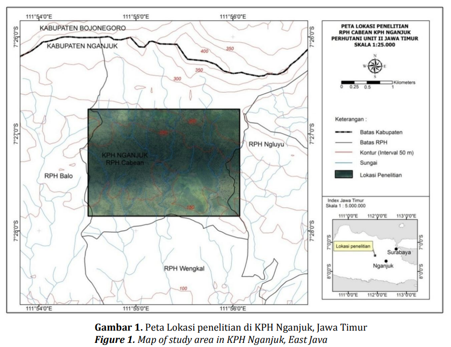
Site quality is one of the main information needed in forest stand management. Site quality classes need to be evaluated every certain period because the quality of forest stands may change as a result of management applied. This study describes the use of very high-resolution imagery derived from unmanned aerial vehicle (UAV) for estimating the site quality of teak (Tectona grandis). The UAV imagery used was taken from 400 m above datum (the average land surface elevation) with ground spatial resolution of 15 cm. Site quality estimation models was built using discriminant analysis. The study found that the best accuracy from discriminant function using multiple variables canopy density (C) and average of crown diameter (Dc ̅̅̅) is 60.9%.
Andriani Y, Cahyawati D, Gusmaryanita V. (2011). Analisis diskriminan untuk mengetahui faktor yang mempengaruhi pilihan program studi matematika di FMIPA dan FKIP Universitas Sriwijaya. Jurnal Penelitian Sains, 14(4), 9–14.
Chianucci, F., Disperati, L., Guzzi, D., Bianchini, D., Nardino, V., Lastri, C., . . . Corona, P. (2016). Estimation of canopy attributes in beech forests using true colour digital images from a small fixed-wing UAV. International Journal of Applied Earth Observation and Geoinformation, 47, 60–68.
Daniel, T. W., Helms, J. A., & Baker, F. S. (1992). Principles of Silviculture. Yogyakarta: Gajah Mada University Press.
Dhani, F. A. R. (2012). Penggunaan citra resolusi tinggi untuk pendugaan sediaan tegakan jati (Tectona grandis, Linn.F) dengan teknik double sampling di KPH Madiun Perum Perhutani Unit II Jawa Timur. [skripsi]. Bogor: Institut Pertanian Bogor.
Hartati, W. (2008). Evaluasi distribusi hara tanah dan tegakan mangium, sengon dan leda pada akhir daur untuk kelestarian produksi hutan tanaman di UMR Gowa PT Inhutani I Unit III Makassar. Jurnal Hutan dan Masyarakat, 3(2), 199–219.
Hayat, S. N. (2015). Pembangunan kelas kualitas tempat tumbuh mangrove menggunakan citra satelit resolusi sedang di IUPHHK–HA PT Kandelia Alam Kalimantan Barat. [skripsi]. Bogor: Institut Pertanian Bogor.
Jaya, I. N. S., & Cahyono, A. B. (2001). Kajian teknis pemanfaatan potret udara non-metrik format kecil pada bidang kehutanan. Jurnal Manajemen Hutan Tropika, 7(1), 55–64.
Jaya, I. N. S., Samsuri, Lastini, T., & Purnama, E. S. (Eds.). (2010). Teknik Inventarisasi Sediaan Ramin di Hutan Rawa Gambut. Bogor: ITTO CITES Project dan Kementerian Kehutanan.
Marini, Y., Emiyati, Hawariyah, S., & Hartuti, M. (2014). Perbandingan metode klasifikasi supervised maximum likelihood dengan klasifikasi berbasis objek untuk inventarisasi lahan tambak di Kabupaten Maros. Makalah dipresentasikan pada Seminar Nasional Penginderaan Jauh tanggal 21 Maret 2014 di Bogor, Indonesia.
McRoberts, R. E., & Tomppo, E. O. (2007). Remote sensing support for national forest inventories. Remote Sensing of Environment, 110(4), 412– 419.
Mesas-Carrascosa, F. J., Notario-García, M. D., Meroño de Larriva, J. E., Sánchez de la Orden, M., & García-Ferrer Porras, A. (2014). Validation of measurements of land plot area using UAV imagery. International Journal of Applied Earth Observation and Geoinformation, 33, 270–279.
Pan, Y., Zhang, J., & Shen, K. (2011). Crop area estimation from UAV transect and MSR image data using spatial sampling method: a simulation experiment. Procedia Environmental Sciences, 7, 110–115.
Pretzsch, H. (2009). Forest Dynamics, Growth and Yield. Heidelberg: Springer.
Rango, A., & Laliberte, A. S. (2010). Impact of flight regulations on effective use of unmanned aircraft systems for natural resources applications. Journal of Applied Remote Sensing, 4, 1–12.
Riyanto, H. D., & Pahlana, U. W. H. (2012). Kajian evaluasi lahan hutan jati sistem bonita di Kesatuan Pemangkuan Hutan (KPH) Cepu. Jurnal penelitian Hutan Tanaman, 9(1), 83–93.
Rokhmana, C. A. (2015). The Potential of UAV-based Remote Sensing for Supporting Precision Agriculture in Indonesia. Procedia Environmental Sciences, 24, 245–253.
Sari, N. M., & Kushardono, D. (2014). Klasifikasi penutup lahan berbasis obyek pada data foto UAV untuk mendukung penyediaan informasi penginderaan jauh skala rinci. Jurnal Penginderaan Jauh, 11(2), 114–127.
Septyawardani, E. (2012). Penyusunan model penduga sediaan tegakan dan biomassa hutan jati (Tectona grandis Linn.F) menggunakan citra dijital non-metrik resolusi tinggi. [skripsi]. Bogor: Institut Pertanian Bogor.
Shofiyanti, R. (2011). Teknologi pesawat tanpa awak untuk pemetaan dan pemantauan tanaman dan lahan pertanian. Informatika Pertanian, 20(2), 58–64.
Sihombing, B. H. (2015). Tinjauan konsep dan implementasi sistem silvikultur TPTII. Jurnal AGRIFOR, 14(1), 27–38.
Simarmata, M. M. (2015). Model penyusunan kualitas tempat tumbuh Eucalyptus urophylla pada hutan tanaman. Jurnal Elektronik AKAR, 1(1), 1–10.
Supranto. (2002). Analisis Multivariat. Arti & Interpretasi. Jakarta: Rineka Cipta.
Suranto, Y., Prayitno, T. A., Marsono, D., & Sutapa, J. P. G. (2015). Pengaruh umur pohon, bonita dan posisi aksial batang terhadap struktur makroskopis dan kualitas kayu jati sebagai bahan furnitur. Jurnal Manusia dan Lingkungan, 22(1), 84–93.
Upadhyay, A., Eid, T., & Sankhayan, P. L. (2005). Construction of site index equations for even aged stands of Tectona grandis (teak) from permanent plot data in India. Forest Ecology and Management, 212, 14–22.
Wahyuni, S. (2012). Identifikasi kualitas tempat tumbuh (bonita) menggunakan citra dijital non metrik resolusi tinggi di KPH Madiun Perum Perhutani Unit II Jawa Timur. [skripsi]. Bogor: Institut Pertanian Bogor.
Wallace, L., Lucieer, A., Watson, C., & Turner, D. (2012). Development of a UAV-LiDAR System with Application to Forest Inventory. Remote Sensing, 4(12), 1519-1543.
Wijayanto, N., & Rhahmi, I. (2013). Panjang dan kedalaman akar lateral jabon (Anthocephalus cadamba (Roxb.) Miq.) di Desa Cibening, Kecamatan Pamijahan Kabupaten Bogor, Jawa Barat. Jurnal Silvikultur Tropika, 4(1), 23–29.
