
Multi-Sensor Data Fusion for Maritime Traffic Surveillance A Systematic Review
Article Sidebar
Main Article Content
Abstract
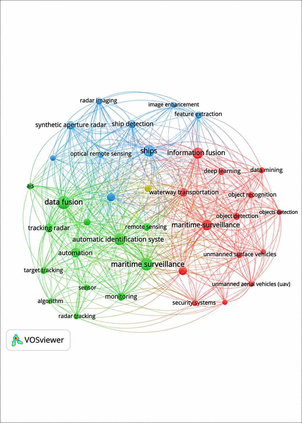
Maritime traffic surveillance requires reliable and comprehensive information to support maritime safety, security, and situational awareness. However, the limitations of individual sensing technologies have increased the need for multi-sensor data fusion to integrate complementary information from heterogeneous sources. This study aims to systematically review the types of sensors integrated for maritime traffic surveillance and the main applications of multi-sensor data fusion in this domain. A systematic literature review was conducted on 69 selected studies, followed by bibliometric analysis using VOSviewer to identify dominant research themes and their relationships. The results show that Automatic Identification System (AIS), radar, camera/visual sensors, satellite/Synthetic Aperture Radar (SAR), and meteorological sensors are among the frequently integrated sensing technologies. Maritime Situational Awareness was the dominant application, identified in 58 of the 69 reviewed studies (84.05%), followed by maritime surveillance, vessel tracking, autonomous navigation, and vessel detection and recognition. The keyword analysis indicates strong research connections among data fusion, AIS, maritime surveillance, vessel detection and tracking, remote sensing, artificial intelligence, and autonomous systems, reflecting a transition from conventional sensor integration toward increasingly intelligent and automated surveillance approaches. Despite these developments, challenges remain in real-time processing, spatiotemporal alignment, heterogeneous data integration, environmental variability, sensor reliability, and anomaly detection. Overall, multi-sensor data fusion provides an important foundation for developing more comprehensive, adaptive, and intelligent maritime traffic surveillance systems and supports the advancement of Maritime Situational Awareness and Maritime Domain Awareness.
Article Details
Section

This work is licensed under a Creative Commons Attribution 4.0 International License.
Allow anyone to modify, improve, and make derivative works, even for commercial purposes, as long as they credit to you for the original work.
How to Cite
References
[1] J. Garcia, J. Luis Guerrero, A. Luis, and J. M. Molina, “Robust sensor fusion in real maritime surveillance scenarios,” in 2010 13th International Conference on Information Fusion, Edinburgh: IEEE, Jul. 2010, pp. 1–8. doi: 10.1109/ICIF.2010.5712037.
[2] B. Bal Şahin, Ç. B. Erdaş, and E. Sümer, “Multi-sensor data fusion in maritime surveillance: a review on methods and applications,” PeerJ Computer Science, vol. 12, p. e3765, Apr. 2026, doi: 10.7717/peerj-cs.3765.
[3] K. Wohlleben et al., “Enhancing Maritime Situational Awareness through Multimodal Fusion: Insights from a Real-World Experiment,” in 2025 IEEE Sensor Data Fusion: Trends, Solutions, Applications (SDF), Bonn, Germany: IEEE, Nov. 2025, pp. 1–8. doi: 10.1109/SDF67080.2025.11331253.
[4] M. Hadzagic, M. Isabelle, and N. Kashyap, “Hard and Soft Data Fusion for Maritime Traffic Monitoring Using the Integrated Ornstein-Uhlenbeck Process,” in 2020 IEEE Conference on Cognitive and Computational Aspects of Situation Management (CogSIMA), Victoria, BC, Canada: IEEE, Aug. 2020, pp. 98–105. doi: 10.1109/CogSIMA49017.2020.9216117.
[5] R. G. Wright, “Intelligent Autonomous Ship Navigation using Multi-Sensor Modalities,” TransNav, vol. 13, no. 3, pp. 503–510, 2019, doi: 10.12716/1001.13.03.03.
[6] M. J. Page et al., “The PRISMA 2020 statement: an updated guideline for reporting systematic reviews,” BMJ, p. n71, Mar. 2021, doi: 10.1136/bmj.n71.
[7] N. J. Van Eck and L. Waltman, “Software survey: VOSviewer, a computer program for bibliometric mapping,” Scientometrics, vol. 84, no. 2, pp. 523–538, Aug. 2010, doi: 10.1007/s11192-009-0146-3.
[8] H. Shi, D. Wang, L. Wei, and S. Liang, “A Sequential Kalman-Newton-KM Framework for AIS and Radar Data Fusion in Restricted Inland Waterways,” Sensors, vol. 26, no. 7, p. 2255, Apr. 2026, doi: 10.3390/s26072255.
[9] J. Qu, R. W. Liu, Y. Guo, Y. Lu, J. Su, and P. Li, “Improving maritime traffic surveillance in inland waterways using the robust fusion of AIS and visual data,” Ocean Engineering, vol. 275, p. 114198, May 2023, doi: 10.1016/j.oceaneng.2023.114198.
[10] Y. Chen, X. Qi, C. Huang, and J. Zheng, “A data fusion method for maritime traffic surveillance: The fusion of AIS data and VHF speech information,” Ocean Engineering, vol. 311, p. 118953, Nov. 2024, doi: 10.1016/j.oceaneng.2024.118953.
[11] J. Liu, S. Zhao, D. An, H. Ding, J. Wang, and X. Huang, “Multimodal Data Fusion-based Graph Neural Networks for Ship Trajectory Prediction,” J CIRCUIT SYST COMP, vol. 35, no. 16, p. 2650012, Sep. 2026, doi: 10.1142/S021812662650012X.
[12] M. Rodger and R. Guida, “Classification-Aided SAR and AIS Data Fusion for Space-Based Maritime Surveillance,” Remote Sensing, vol. 13, no. 1, p. 104, Dec. 2020, doi: 10.3390/rs13010104.
[13] K. Wolsing, L. Roepert, J. Bauer, and K. Wehrle, “Anomaly Detection in Maritime AIS Tracks: A Review of Recent Approaches,” JMSE, vol. 10, no. 1, p. 112, Jan. 2022, doi: 10.3390/jmse10010112.
[14] B. Habtemariam, R. Tharmarasa, M. McDonald, and T. Kirubarajan, “Measurement level AIS/radar fusion,” Signal Processing, vol. 106, pp. 348–357, Jan. 2015, doi: 10.1016/j.sigpro.2014.07.029.
[15] L. Achiri, R. Guida, and P. Iervolino, “SAR and AIS Fusion for Maritime Surveillance,” in 2018 IEEE 4th International Forum on Research and Technology for Society and Industry (RTSI), Palermo: IEEE, Sep. 2018, pp. 1–4. doi: 10.1109/RTSI.2018.8548352.
[16] Y. Wu et al., “A new multi-sensor fusion approach for integrated ship motion perception in inland waterways,” Measurement, vol. 200, p. 111630, Aug. 2022, doi: 10.1016/j.measurement.2022.111630.