
Digitalization of Marine Space Utilization Guidance Based on Web-gis in the Work area of BPSPL Makassar
Article Sidebar
Main Article Content
Abstract
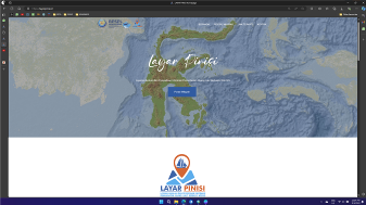
The enactment of Law Number 6 of 2023 concerning the Ratification of Government Regulation in Lieu of Law Number 2 of 2022 on Job Creation into Law requires that any permanent utilization of marine space must have basic permit for marine spatial utilization activities (KKPRL). The process of granting KKPRL permit is carried out by assessing the conformity of activities with the guidelines for zoning water space utilization based on the Regional Spatial Plan issued by the Provincial Government. The lack of information regarding the guidelines for marine space utilization causes applicants for marine space utilization activities to be unaware of the guidelines that can be applied to the location, thus hindering the process of issuing the KKPRL permit. The research aims to design a digitalization system for providing spatial utilization guidelines documents in the work area of BPSPL Makassar, which can be accessed online by marine space utilization stakeholders. This will facilitate checking the conformity of marine space utilization activities and accelerate the process of issuing the KKPRL permit. As an initial step, a digitalization system for marine spatial utilization guidelines was designed for two provinces in the work area of BPSPL Makassar, which have integrated the marine spatial planning and land spatial planning into Regional Spatial Plan (RTRWP), namely South Sulawesi Province and Central Sulawesi Province. This initial design will continue to be developed in line with the availability of RTRWP integration documents in four other provinces within the work area of BPSPL Makassar.
Keywords: digitalized, guidelines, spatial, webgis
Downloads
Article Details

This work is licensed under a Creative Commons Attribution 4.0 International License.
Allow anyone to modify, improve, and make derivative works, even for commercial purposes, as long as they credit to you for the original work.
Accepted 2025-03-30
Published 2025-03-31
References
Yusma, A. M. I. (2024). Implementation report on public service change actions: Optimization of services through the Guidance and Provision of Information Portal (Layar Pinisi) for marine space utilization based on WebGIS. Lembaga Administrasi Negara.
BPSPL Makassar. (2024). Final report on the development of the WebGIS-based application 'Guidance and Provision of Spatial-Based Information on the Suitability of Marine Space Utilization (LAYAR PINISI)' in the Sulawesi region for the fiscal year 2024. Balai Pengelolaan Sumberdaya Pesisir dan Laut Makassar.
Indonesia Government, (2023). Law No. 6 of 2023 on the stipulation of the government regulation in lieu of law No. 2 of 2022 on job creation. Jakarta.
Kementerian Kelautan dan Perikanan RI. (2023). Ministerial regulation No. 28 of 2021 on marine spatial planning. Jakarta.
Pemerintah Provinsi Sulawesi Selatan. (2022). Regional regulation No. 3 of 2022 on the provincial spatial planning of South Sulawesi for the years 2022–2041. Makassar.