
MODELLING THE CURRENT OF THE TALLO RIVER IN MAKASSAR USING NUMERICAL MODELLING SOFTWARE
Article Sidebar
Main Article Content
Abstract
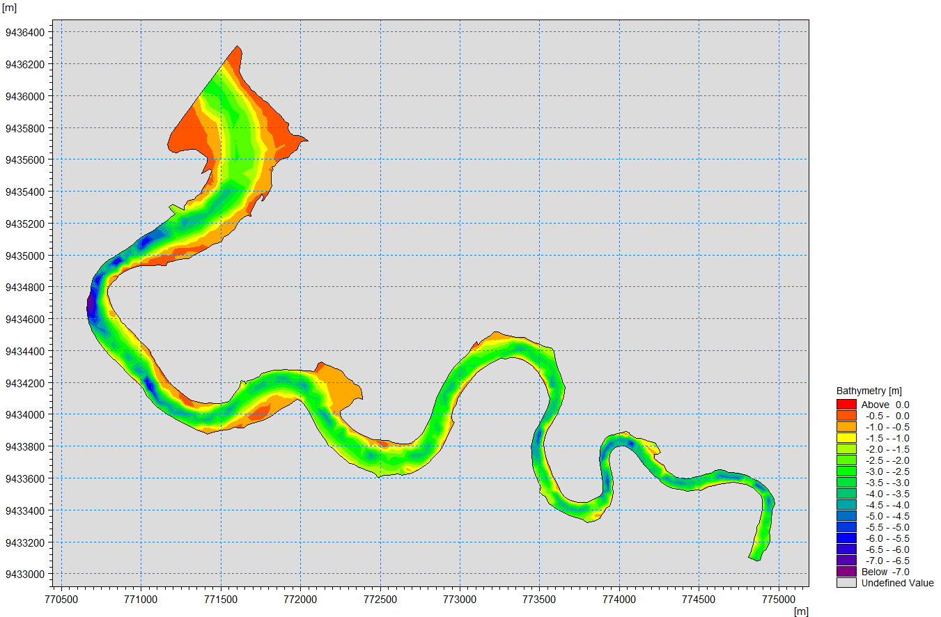
Tallo River is located in Makassar City, South Sulawesi, and has an important role in the Mamminasata region. The flow of the Tallo River that crosses the center of Makassar City has a strategic location in the urban area of Mamminasata. Ocean currents refer to the movement of water masses, both horizontally and vertically, that reach equilibrium. Factors that affect ocean currents include pressure gradients, winds, pressure or density differences, and tides. In many waters, the main factors affecting the strength of currents are wind and tides. The data used in this study included riverbank line data from Google Earth Pro, tidal data measured directly in the field from two different points, namely the Monkey pier and the Tallo pier, bathymetric data used to create an unstructured network taken directly in the field, and wind data obtained from ECMWF. The results showed that the water level in the Tallo River, Makassar, South Sulawesi was influenced by tides. At low tide, the river flow flows towards the mouth of the river, while at high tide, the direction of the river flow towards the upper reaches of the river with the current rotating in certain locations. The water level in the Tallo River ranges from 0.8 to 2.2 meters, and the current speed varies between 0.015 to 0.21 m/s.
Downloads
Article Details
References
Ikhsan, A. M. (N.D.). Strategi Pengembangan Kawasan Ekowisata Tepian Sungai Tallo Di Makassar.
Wunas, S., & Taufiqur Rachman, Dan. (N.D.). Pengembangan Sistem Transportasi Sungai Dalam Mendukung Ekowisata Sungai Tallo Kota Makassar-Pengembangan Sistem Transportasi Sungai Dalam Mendukung Ekowisata Sungai Tallo Kota Makassar River Transport System Development In Supporting Tallo River Ecotourism Makassar.
Siagian EN. Simulasi pemodelan sirkulasi hidrodinamika arus pasang surut diperairan kolam alur Pelabuhan Belawan Sumatera Utara [skripsi]. Indralaya: Program Studi Ilmu Kelautan, FMIPA, Universitas Sriwijaya, (2010).
Poerbandono DN, Djunarsjah E. Survey Hidrografi. Bandung: Rafika Aditama, 2005.