
Shoreline Change Analysis on Enggano Island Using the Digital Shoreline Analysis System (DSAS): A Case Study of Kahyapu, Kaana, and Malakoni Villages
Article Sidebar
Main Article Content
Abstract
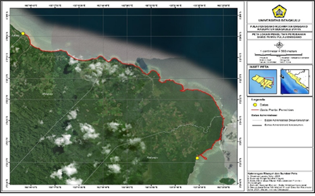
Coastal shoreline change is a dynamic process that significantly affects coastal ecosystems and human activities. This study quantitatively analyzed shoreline changes along the coast of Enggano Island, Bengkulu Province, during the period 1993–2025, focusing on Kahyapu, Kaana, and Malakoni Villages. Shoreline extraction was performed using Landsat imagery from 1993, 2009, and 2025 after radiometric and geometric corrections, employing the Modified Normalized Difference Water Index (MNDWI) and tidal correction based on MIKE 21 modeling and bathymetric data. Shoreline change rates were calculated using the Digital Shoreline Analysis System (DSAS) with 2,052 transects at 10 m spacing and the parameters Net Shoreline Movement (NSM), End Point Rate (EPR), and Linear Regression Rate (LRR). The results indicate that shoreline retreat due to erosion dominates all study areas. During 1993–2009, average erosion rates ranged from −0.42 to −0.63 m/year and increased markedly during 2009–2025, reaching up to −1.26 m/year in Malakoni Village. Long-term trend analysis for 1993–2025 shows the highest erosion rate in Malakoni (−0.87 m/year), followed by Kaana (−0.56 m/year) and Kahyapu (−0.44 m/year). Accretion occurred only locally and at relatively low rates, insufficient to offset land loss. These findings confirm that the coastal areas of Enggano Island are highly vulnerable to continuous erosion and emphasize the need for integrated and sustainable coastal management strategies.
Downloads
Article Details

This work is licensed under a Creative Commons Attribution 4.0 International License.
Allow anyone to modify, improve, and make derivative works, even for commercial purposes, as long as they credit to you for the original work.
Accepted 2026-02-11
Published 2026-03-28
References
[1] Pemerintah Republik Indonesia, Peraturan Presiden Republik Indonesia Nomor 78 Tahun 2005 tentang Pengelolaan Pulau-Pulau Kecil Terluar, Jakarta: Sekretariat Negara, 2005.
[2] P. Sari, “Harmoni dalam kebhinekaan (kearifan lokal masyarakat Pulau Enggano Provinsi Bengkulu dalam mengatasi konflik),” Jurnal Antropologi: Isu-Isu Sosial Budaya, vol. 19, no. 2, pp. 139–147, 2017.
[3] M. I. Arisaputra, “Penguasaan tanah pantai dan wilayah pesisir di Indonesia,” Perspektif Hukum, vol. 15, no. 1, pp. 27–44, 2015.
[4] A. C. Wakkary, M. I. Jasin, and A. K. T. Dundu, “Studi karakteristik gelombang pada daerah pantai Desa Kalinaung Kabupaten Minahasa Utara,” Jurnal Sipil Statik, vol. 5, no. 3, pp. 167–174, 2017.
[5] D. P. Lubis, M. Pinem, and M. A. N. Simanjuntak, “Analisis perubahan garis pantai dengan menggunakan citra penginderaan jauh (studi kasus di Kecamatan Talawi Kabupaten Batubara),” Jurnal Geografi, vol. 9, no. 1, pp. 21–31, 2017.
[6] N. Hidayati and H. S. Purnawali, “Deteksi perubahan garis pantai Pulau Gili Ketapang Kabupaten Probolinggo,” in Seminar Nasional Perikanan dan Kelautan V, May 2015, pp. 570–574.
[7] A. A. Aniendra, B. Sasmito, and A. Sukmono, “Analisis perubahan garis pantai dan hubungannya dengan land subsidence menggunakan aplikasi Digital Shoreline Analysis System (DSAS) (studi kasus: wilayah pesisir Kota Semarang),” Jurnal Geodesi Undip, vol. 9, no. 1, pp. 12–19, 2020.
[8] F. A. Maulana, K. Amri, and Besperi, “Prediksi perubahan garis pantai Bengkulu (studi kasus Pantai Zakat Kota Bengkulu),” RADIAL: Jurnal Peradaban Sains, Rekayasa dan Teknologi, vol. 9, no. 1, pp. 15–22, 2021.
[9] T. Rachman, H. Umar, and I. H. Bahtiar, “Dampak perubahan garis pantai terhadap pemanfaatan lahan pesisir Kecamatan Tamalanrea Kota Makassar,” Zona Laut: Jurnal Inovasi Sains dan Teknologi Kelautan, vol. 3, no. 1, pp. 7–14, 2022.
[10] N. A. Gunawan, R. Ekawita, Supiyati, and Anjasman, “Analisis perubahan garis pantai Pulau Enggano Bengkulu Utara menggunakan aplikasi Digital Shoreline Analysis System (DSAS),” Jurnal Fisika Unand, vol. 13, no. 6, pp. 756–761, 2024.
[11] N. K. Sydney, “Implementasi metode Admiralty dalam menganalisis karakteristik harmonik pasang surut air laut di perairan Semarang,” CASTLE Proceeding, vol. 4, pp. 48–56, 2024.
[12] S. Maharani, M. P. Suhana, and E. Kurniawati, “Pemetaan perubahan garis pantai di Pantai Tanjung Siambang, Pulau Dompak dengan metode Digital Shoreline Analysis System (DSAS),” Jurnal Kelautan: Indonesian Journal of Marine Science and Technology, vol. 16, no. 2, pp. 177–190, 2023.
[13] U.S. Geological Survey, Landsat Missions Overview, 2018. [Online]. Available: https://www.usgs.gov/core-science-systems/nli/landsat
[14] F. Istiqomah, B. Sasmito, and F. J. Amarrohman, “Pemantauan perubahan garis pantai menggunakan aplikasi Digital Shoreline Analysis System (DSAS),” Jurnal Geodesi Undip, vol. 5, no. 1, pp. 78–89, 2016.